Friday, November 22, 2013

Seattle, Part 1

Digital Souvenir from the Space Needle
I made it into Redmond around 6pm and met up with Max. We stopped for food at Highscore Burgers, a burger place themed around video games. After driving the whole day, a burger and a beer is just what I needed. Max and I caught up on what had happened since Olympic and settled into playing Gauntlet on one of the cabinets. Friends, good food, video games, beer...I could get used to this!

We went back to his apartment and I set up my replacement laptop. This was the first time that I was able to access a computer since my other one was stolen in San Francisco, so I had a lot to catch up on. It was already pretty late, but I had to get my itemized list of all items taken with the backpack into the insurance company so they could reimburse me. So between adding items to the list, my computer was rebooting for updates. I didn't get to bed until 2am.

The next day was spent trying to catch up on everything. I hadn't written a blog post in a while, nor had I really sorted through email or paid bills. It took all day for me to sort through everything and get some semblance of being "caught up".

That night, I met up with one of Max's friends from Michigan State who also works for Microsoft. Max, Zach, and myself went to the Malt and Vine for beers. They had a lot of import and craft beers on tap, as well as a huge bottle selection. If Max was trying to convince me to move out to Seattle (which he was), he knew exactly where to take me.

We went to pick up Cait from the airport the following day. She was out of town for work and had hardly been in Seattle since they moved out there. We went downtown to the Yardhouse to celebrate. I saw one of these in Long Beach that had one of the biggest porches I had ever seen. They had a beer selection the rivaled the Malt and Vine, but the food was also excellent. After dinner and drinks we went back to the apartment for a movie.

I was able to meet up with Milan after work on Monday. I have known Milan for about 7 years, starting with him being my mentor for a class back at Michigan Tech. He works for Microsoft as Business Manager/Chief of Staff, Bing Experiences in Bellevue. I hadn't seen him for almost 4 years, so it was good to see him again. He showed me around his office, and we went back to his apartment where we had dinner and I met his wife. We talked about Michigan Tech and Gridalogy, trying to figure out where everyone on the team was and how they were doing. He gave me some ideas on what to visit and wished me luck on my trip.

The next day I met up with Scott, one of my fellow FCGs from Ford. He had moved out to Seattle after being hired by Microsoft this summer. It was good to catch up and chat about the similarities and differences of working for Ford and Microsoft. We had lunch at the Microsoft Cafeteria, which put any other corporate cafeteria to shame. It seems like he is fitting right in and doing well!

I finally made my way into Seattle to explore the following day. The apartment is right on the 545 route into the city, so taking the bus was the obvious choice. If I were to drive my car I would not only need to pay the fee for crossing the bridge, but I would have to pay for parking. Once downtown, I could walk pretty much anywhere.

My first stop was the Space Needle. It was a rather touristy thing to go visit, but worth it all the same. It was mostly clear, and so I could see pretty far into the distance. The top is open for a full 360° view. I wasn't able to see Rainier, but I could still see most of the city.


These guys are visible from the top. Pretty cool art.
I thought about grabbing some food from the restaurant until I saw the prices. Even the trick I used on the Queen Mary of just getting soup would have been rather expensive. I decided against it and moved on.

 My next stop was the Chihuly Glass Garden. This was a really cool exhibit. I never knew you could make some of these shapes with glass, let alone make them structurally sound. I will let some of the pictures speak for themselves.


After visiting the gardens, I tried to meet up with Kali at her new job. She works really close to the Space Needle at Third and Wall Art. Unfortunately she just got really busy at work and I couldn't stop by. She suggested I make my way down to Pike Place Market instead. I set off to find the first Starbucks!
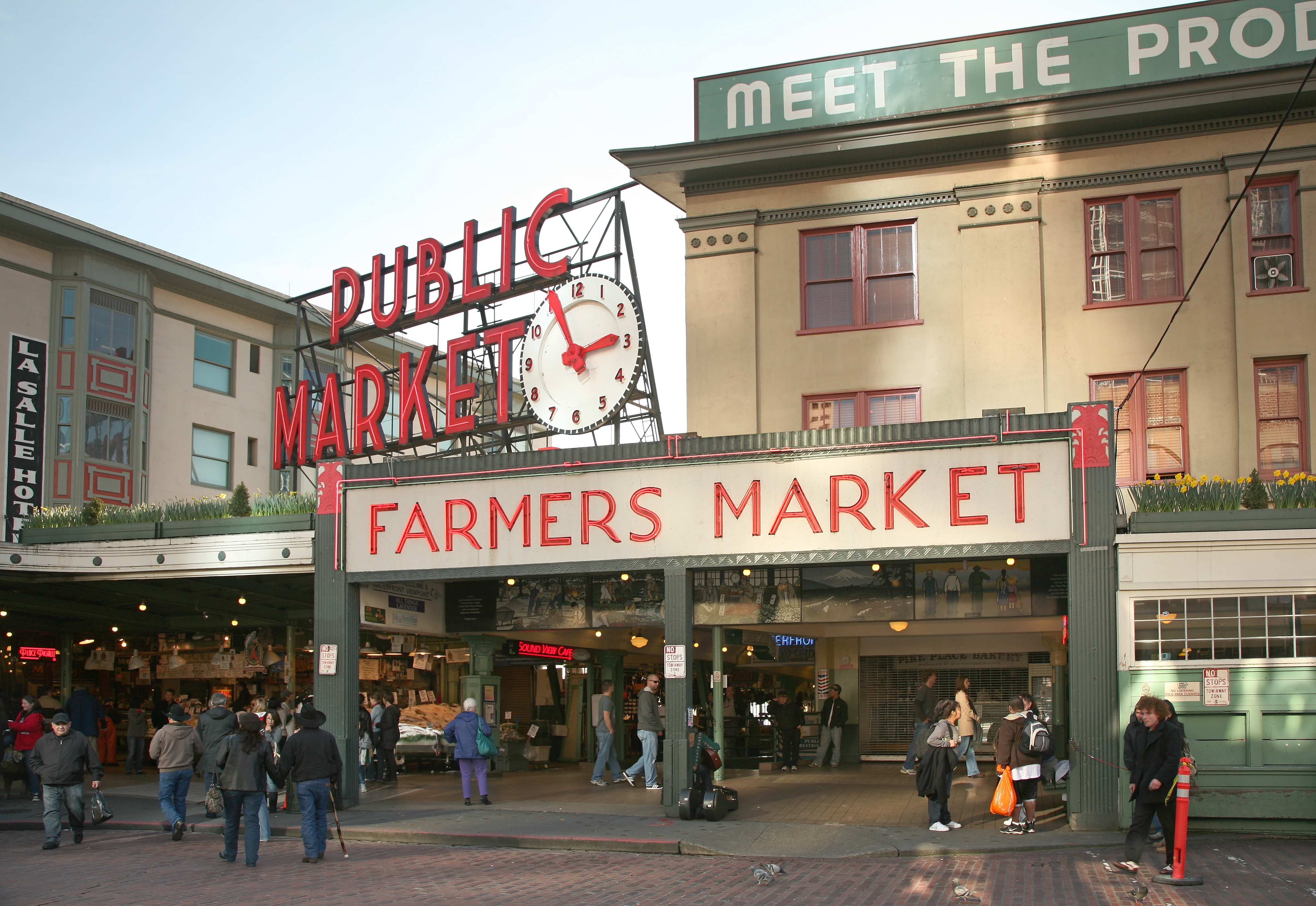
Taken from Wikipedia. Forget to get a picture for myself...
Pike Place Market is really a unique experience. From fishmongers throwing fish, to fresh produce samples, to every type of food imaginable, to people selling any trinket under the sun. I saw fresh bread, fresh fish and meat, fresh veggies, fresh peppers, and fresh spices: everything that you would need to cook a fantastic meal. There was also a knife store that had many different cooking tools. Truly a cooks dream.

I wandered around for an hour or so trying to find the Starbucks. I was unsuccessful and wandered into a Starbucks a block away, figuring that this had to be the one. It was a first store, but not THE first store. The store I visited was the first chain store. They were kind enough to give me directions to the very first store.

The first Starbucks was absolutely packed. There was barely enough room to stand, so I decided to cut my losses. I found it, that was good enough.


I had a few hours to kill, so I made my way back to the Seattle Center. The Seattle Center was the site for the World's Fair in 1962. The Space Needle was built specifically for the fair. I wandered around for a bit, looking at the different buildings. I stopped at the fountain and watched a group of dancers practice around it. I assume it was for one of the many festivals held here.

To end the day, I met up with my friend Ivor. We both played football at Saint Francis, but lost touch after we graduated. He also works for Microsoft, but in the Office division. We caught up, talked about work, talked about the area, and future projects.

Who know that I knew this many people in the Seattle Area?

Pictures of Seattle

Tuesday, November 19, 2013

Portland

Random bar encounter.
I made it into Portland around 7pm. I found another place to stay on AirBnB, this time with Shannon, Brian, and Kieran. I also met Barry (the older gentleman in the picture above), as he was also staying at the same place. He is also traveling the country, but zigzagging through the center. He is from England, but has been all over the world since he retired. We traded stories for a bit and then decided to head out to the bar.

We started chatting with some people sitting next to us at the bar and had a really fun time. I was asking about Portland, what to do and why they lived there. Barry told stories about his travels. We stayed out pretty late.

When we got back to the house, Brian gave me some ideas for tomorrow. We also talked about beer and coffee. Two of my favorite things!


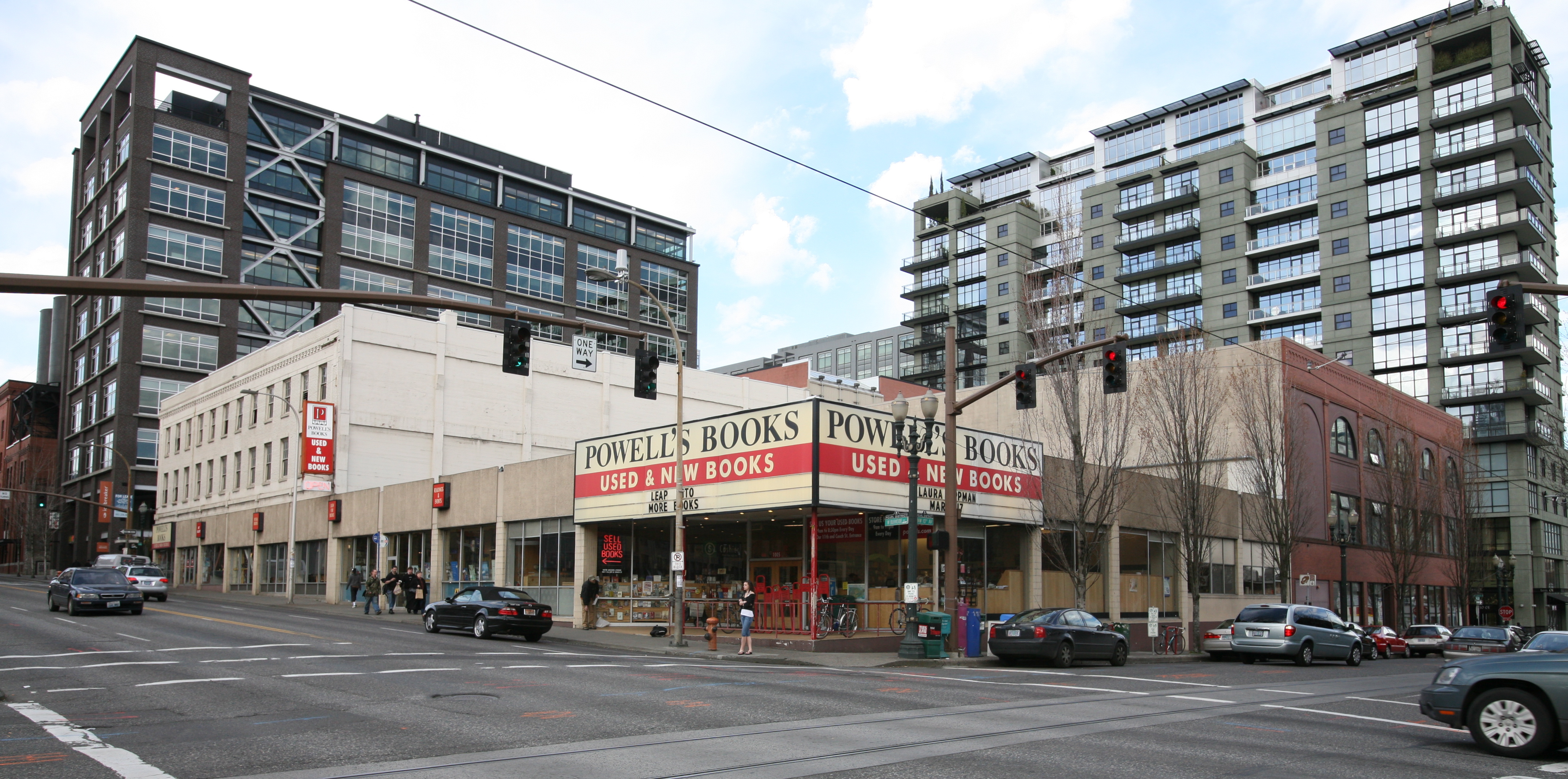
Very dangerous place. So many books, so little money...
The first stop was Powell's Books. It is the largest independent bookstore in Portland (state? country?). They covered everything anyone could want. I picked up three books, spending about $50. I had to leave or I would have picked up another $50 worth of books.

Thai Peanut wings were fantastic!
I made my way to a wing joint called "Fire on the Mountain". Brian said that there really wasn't a good wing spot anywhere before, which was weird since Portland is known for their food. I tried the Thai Peanut and they were super good. Not super spicy, but full of flavor. If you are in Portland, you should visit!

After lunch, I just wandered around the city and explored. I didn't really have any goal in mind, so I didn't really take many pictures. My day was going really well, but for some reason I was in a funk.

I tried to go visit the park (one of the largest parks within the borders of a city in the US). After getting turned around a few times, I eventually found a place to park to wander on a trail. Just as I was about to set off, I saw automotive glass mixed in with the rocks in the parking lot. I was instantly reminded of San Francisco and couldn't bring myself to leave my vehicle alone.

I decided I would head back to the house and explore in that area for a little while. I ate dinner and wandered around, but I couldn't shake the funk. I was thinking about "what am I going to do when this is all over", "what if I run out of money", and "what if I can't find another job". Slightly over-dramatic, I know, but at the time they were very real fears. This was the first big city that I had visited where I knew NO ONE. I talked with my parents and sister about it, but I still couldn't shake the effects. I didn't really feel like drinking alone, so I went to bed early.

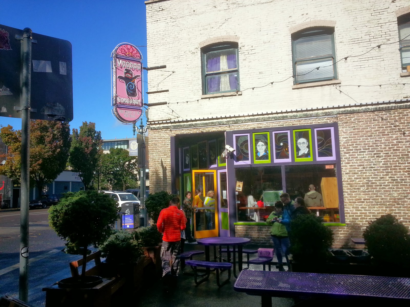
I woke up, checked out with Shannon (I highly recommend staying there if you stop in Portland), hopped in my car, and made my way downtown. I decided to make one more stop at Voodoo Doughnuts (because why not?), and then I would head west to the beach.

Last stop before leaving Portland. Took a dozen doughnuts with me!
My next destination was going to be Mt. Rainier or Mount St Helens, but this is when the government shut down. My precious National Parks were all closed because some clowns in Congress couldn't do the one thing they were paid to do: keep the country running. Not able to visit those, I decided to head up to Seattle instead and visit Max and Cait.

Since Max wasn't going to be off of work until 6pm, I left for Oswald West State Park. It was a little out of the way, but I think that was the draw. The reviews for the place mention this as people's own private paradise. I agree, and can imagine it being wonderful during the summer months.

Fantastic beach, but mostly deserted. The temperature might have something to do with it.

Looking back towards the beach entrance.


This must have washed ashore during high tide. Some of them were still alive.
I checked out a few other beaches on my way north. I think this cave was at either Hug Point or Arcadia.


After checking out the beaches, I made my way north. I stopped in Astoria for some Clam Chowder. It was fantastic. I also tried some Salmon Jerky. It was a really different flavor than I was expecting. Not particularly great, but not too bad.

Pictures of Oswald West State Park

Thursday, November 14, 2013

Olympic National Park

Waterfall near Lake Quinault
After waking up early at the rest area, I found out my friends were visiting Olympic National Park. I high tailed it up there, stopping in Portland for a quick Voodoo Doughnuts run.

The Maple Bacon Doughnut, complete with thick cut bacon. Tasty!
I made my way to Lake Quinault, where Max, Cait, and Max's parents were staying for the weekend. It was a really cozy place, and it reminded me a lot of the lodge on Crater Lake. We even got to "crash" a wedding that was moved inside because of the weather.

Getting some ideas for New Years from the minister.
There was a pool inside and Cait was acting as our drill sergeant: do laps, use the ladder for pull ups, do inverted sit ups! We were all pretty exhausted, but we still had time to play some Settlers of Catan and Wild Rummy.

I was able to hang out with them for two days before they had to take off back to Seattle. It was nice sleeping inside, out of the rain, and out of my car for a change.

When they left, I went on to explore the rest of the park, starting with the Quinault area. I saw waterfalls, some tall trees, and backtracked a little to see the Fish Hatchery.

Same waterfall as the first picture, but you can see additional falls on the left, due to the amount of rain.

Worlds Largest Spruce

Another tall tree. I forget what kind though...

Taken from inside the tree.

The fish hatchery, responsible for many different species of Salmon.

Olympic is a BIG park. There are also no real roads that run all the way through the park. This means that you need to drive around it to see the different sights.


All the rain had another effect: some of the roads were washed out. I wanted to go visit the Hoh Rain Forest, but there were sections of road covered with a foot of rainwater. Until they could remove the water, they couldn't tell if there was any damage to the road.

I stopped at the ranger station to find good places to see. They had mentioned the beaches, but warned against the tides. I checked out what I could while trying to stay dry.

Debris carried from the river at Ruby Beach.

Ruby Beach. I was told it looks much better in the sun.

Either First Beach or Rialto Beach near La Push.
I continued on the road until I reached Sol Duc. They have some hot springs there, and for $15, I figured it was worth a soak. The water reminded me a little of the soft water you find in rural parts of the country; kind of soap-like. It was also a little strange being outside and being rained on while sitting in the spring.

I talked with a couple of the other visitors staying the night. There was someone else who was making a National Parks trip like me. Looking back, it is likely that most of her plans were ruined by the government shutdown, which really sucks since she had been planning this for a few years.

I left the pools and decided with the last few hours of "daylight", I would try and see some more falls. The paths were soaked and flooded, so I wasn't able to go as far as I wanted. Google did make a cool gif of my pictures of a stream though.

Cool feature!
Wet and a little cold, I decided I was going to head back and make some dinner. I looked around for a pavilion or something that I could cook under, but I didn't see anything. I had two options, either I cook my food in the bathroom, or cook it under a map for the trail. I picked the latter. A park ranger stopped by almost as soon as I started cooking and I freaked out a little. Technically I don't think I should have been cooking under the sign, but he let it slide. He was kind enough to just wave and let me continue to make dinner.
Making some dinner underneath a map. It was either here or the bathrooms...
I found out that the Rangers were kind as far as cooking food, but didn't like it when you "camped" outside of campsites. Not really wanting to set up camp in the rain, I spent another night in my car.

From Sol Duc, I went towards the visitors center to try and catch Hurricane Ridge. On a nice day, you can see Seattle from the top. Along the way, I stopped to see Madison Falls. Like the other falls, it was very active from all the rain.


The sun was trying it's best to shine!
Again, the weather had conspired against me and the road up to Hurricane Ridge was closed because of snow. They had webcams in the visitor center, and you wouldn't have been able to see 3 feet in front of you, let alone Seattle.

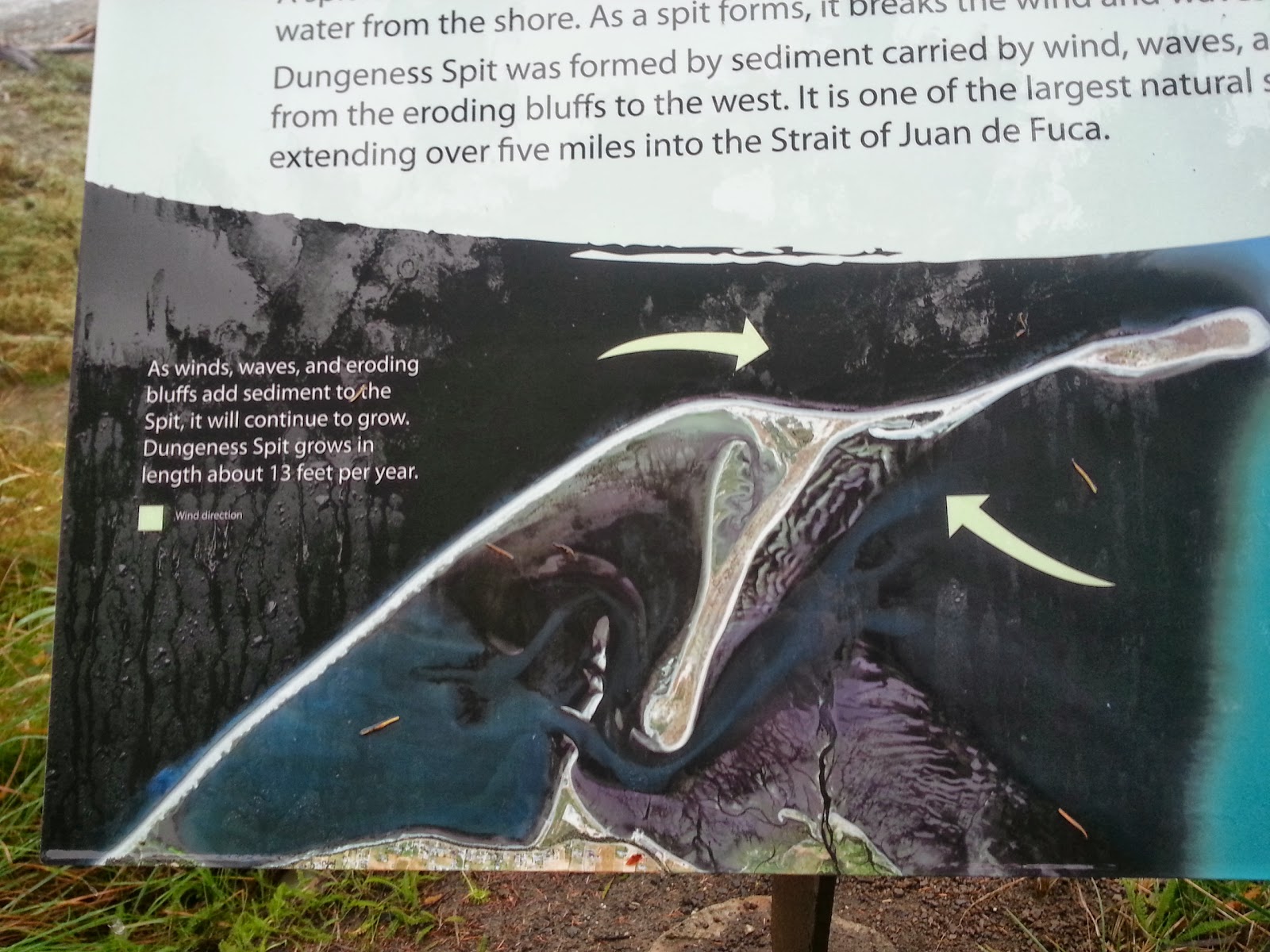
The visitor center suggested I either go into town for a drink (it was only 10am) or I could check out the Dungeness Spit. Not feeling much like drinking, I opted for the second choice.


Marker for the National Park.

There is a lighthouse pretty far down. The weather was getting worse, so I decided to head back.
At this point, there really wasn't anything else to see in the park. I decided I would head back south to Portland. I ended up getting a little lost on a back road to a state park and saw the sign for a boy scout camp.

Haven't heard of this High Adventure camp before, but I am jealous of the scouts who can explore the park!
As I was leaving the park, the clouds parted and gave me a beautiful picture.

Too bad it didn't stay this clear.
Photos of Olympic National Park

Wednesday, November 13, 2013

Natural Bridges, Smith Rock, and McKenzie Pass Lava Beds

Rogue River rapids, upstream from the bridges
I went north to see the "natural bridges" in Rogue River National Park. It was much warmer down at the base of Crater Lake, than at the top. However, there was still frost on the bridges and railings.

"Natural Bridges" are formed when a river uses old lava tubes to flow underground. Some of the bridges may be short, hiding the river for only a few feet, or much longer. There are occasionally holes in the top of the lava tubes, allowing you to look inside. Conversely, the river can also "drill" holes as particles get caught in small holes and pushed in whirlpools by the river.

A partially collapsed lava tube
An example of a natural bridge. This one flows over the top during the spring melt.
The camp was closed, so there wasn't much else to see at the park. Onward north to my next stop!

Heading north, I was greeted by this amazing sight.

Mt. Thielsen
Mt. Thielsen is a pretty cool mountain. It is the remnant of a old volcano, taller than it's current peak. Erosion exposed the hardened core of the volcano (the black spot on top). It has become a sort of lightning rod, and there is evidence of melted rock at the peak.

Smith Rock State Park
I continued to north to Smith Rock State Park. This park is really popular with rock climbers, and they were out in force this day. This is because of the type of rock found here. Everything is sedimentary rock, formed by compressed ash from a nearby eruption. The peaks and valleys are formed by the river that runs through the park.

The hikes up the mountain were really fun as well, as you could see a full 360° view of the surrounding area.
Aptly named trail. This was a pretty steep hike.
The river that helped form the park.
A view of the parking lot area. I am not sure what mountain is in the distance.
After hitting the peak, the trail was much easier. It took you downhill, past Monkey Face rock, probably one of the pinnacle climbs of the park.

Can you spot the people climbing the pinnacle?

How about now? Not for me, but awesome to watch. They were heading to the tiny crevice near the top.
The trail took you along the river path. There were a lot of really nice homes right next to the park. There were a couple of cool sights that were less dangerous than climbing up a rock face.

Rock stacking seems more my skill level.

A friendly guy. This is as close as I felt like getting to him; didn't want to piss him off.
The Rattle Snake was pointed out to me by a father and son walking the lake trail. We continued walking back together and talking. The son lived nearby in Redmond, OR and the father was out visiting. The son liked to try and hike at least one a month out here, and I can see why. This is a really beautiful park.


As I was leaving, rain clouds were starting to close in. I felt pretty bad for all the climbers, but they might be used to the weather. I went west to my last stop for the day: the McKenzie Pass Lava Beds.

Those clouds that I mentioned? They were hanging over the lava beds. This was unfortunate, because you couldn't really see anything. Everything was covered in a thick mist, and the rain was blowing sideways in some areas. However, I spotted something on the road that I HAD to check out.

If you see a structure built out of lava rock, you have to go check out inside!
There were 4 main openings and many differently portholes that framed all of the nearby mountains. Unfortunately, I couldn't see more than a mile in any direction.

Compass at the top of the structure.

My attempt at the full 360° shot. Too bad there was the rain...
With it starting to get dark, I decided I would call it a night. The campsites at McKenzie pass looked a little sketchy. There were bullet holes in the signs out there, and it looked more like a two-track kind of place. I decided I would try and get closer to Portland.

I tried looking for a campsite nearby highway 5, but struck out two times: one was closed for the year, the other was booked. I finally gave up, pulled into a rest stop, and slept in my car. After sleeping in my car in Crater Lake, I found improvements to my methods and was able to sleep pretty soundly until 6am the next morning.

Photos of Natural Bridges, Smith Rock, and McKenzie Pass Lava Beds